
Published on our October 2022 Newsletter
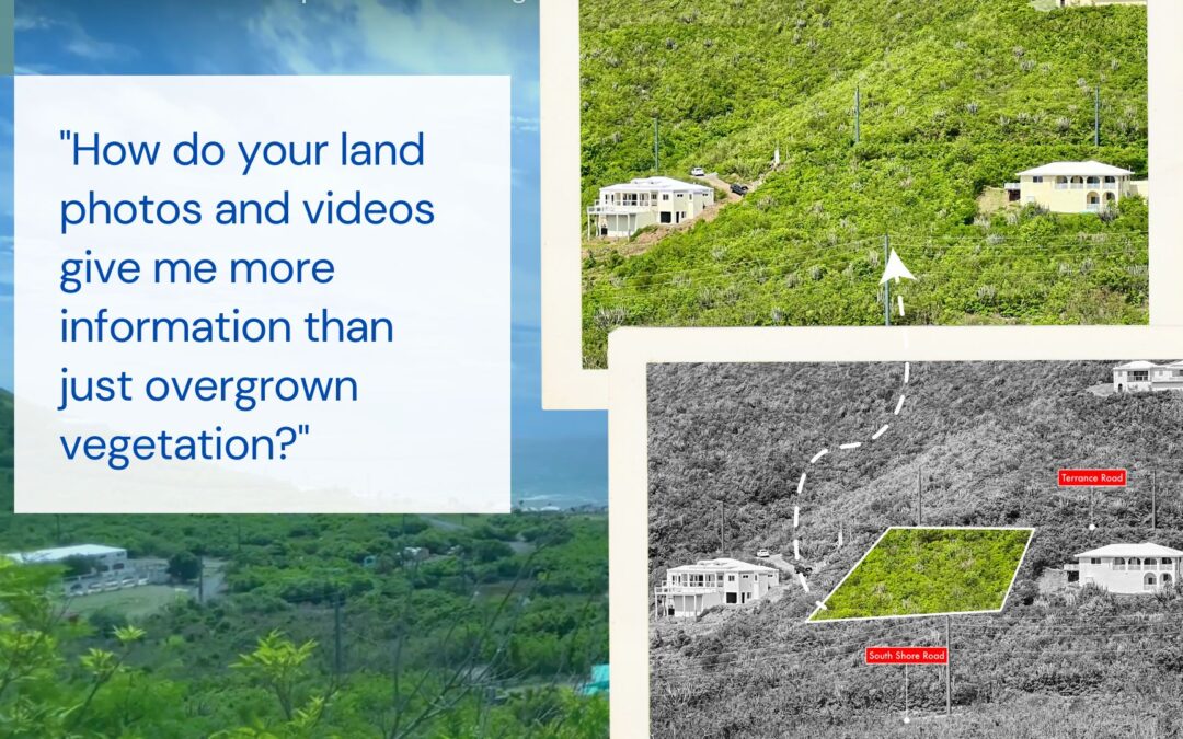
Question: “How do your land photos and videos give me more information than just overgrown vegetation?“
Chris’ Answer:
Imagining boundaries on land parcel photographs is difficult. An aerial mapping photograph can help, but only from an overhead view. We are now including approximate drawings of the boundaries on our photos so that you can better envision the shape of the lot as you look at the different views. Some of the photographs have the lot drawn, and all of the surrounding land is black and white. We feel this helps make the shape of the lot really stand out! We also include the names of the roads, and any landmarks to give you reference points. This can assist you in finding the lot as you drive around. It also helps you if you are off island to better understand the location of the lot. In our videos, we attempt to give as many overhead and angled views to try to show the slope and what your view might be if you built your home there.
Image from our listing at 72 South Grapetree, St Croix USVI. View listing here.
#realestatemarketing #sellingland #landsales #realestate #realtor #coldwellbanker #islandhomes #caribbean #stcroixusvi #virginislands